Wed., 9/30/15 – Ivalo to Kirkenes, Embark our Ship, and Walk in Vardo, Norway
We left our comfortable hotel at 7:15 and headed north to board our ship. We stopped along the way at a fishing camp where the owner had prepared sweet rolls and coffee or tea for us for 6 Euros ($6.50). Since we had a light quick breakfast at the hotel, this was a nice rest stop.
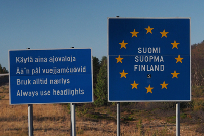
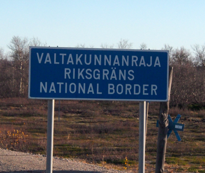
Next stop was at the border between Finland and Norway. There were a few signs telling you this was a country border, but mostly the cattle guard in the road and the reindeer fence marked the border. Eva and Harry, our driver, gave us a shot of cloudberry liqueur and rye chips to mark the occasion of the crossing. The landscape this far north in Norway is very different from that near Ivalo. There are almost no pine trees and the birch trees do not grow in masses. It really is very stark. We did see reindeer along the road, however.
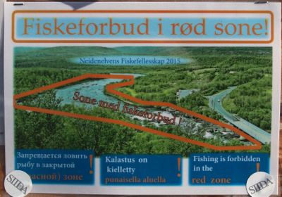
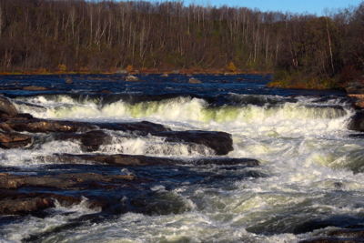
We stopped again at a waterfall, Skoltefoss, on the Neidenelva River. It was really a section of rapids that the salmon could use as a fish ladder.
Norwegian Flag
Finland-Norway border
Skoltefoss - waterfall on the Neidenelva river
Skoltefoss - waterfall on the Neidenelva river
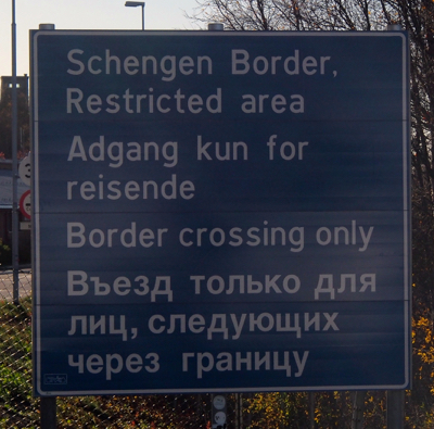
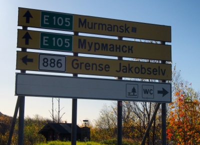
Next we stopped at a Norwegian border crossing with Russia. We could spit across to Russia but only cars and trucks could cross and go through all the checkpoints like we did crossing from Estonia into Russia several days ago. This is also a Schengen Border because Russia is not in the EU. It was intriguing to see a sign with the distance to Murmansk, Russia, a city in a game we played as children. It seemed far away and exotic to a child.
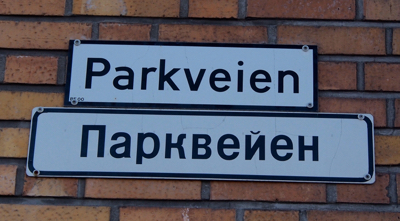
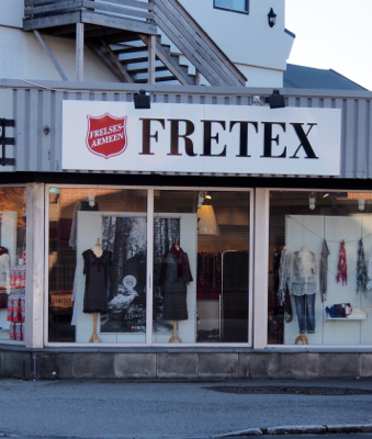
We arrived in Kirkenes, Norway early so we walked around this quiet town, visiting the ATM for Norwegian kroner, the Salvation Army store, a sports store, and a grocery. We did not find anything to buy. Kirkenes has iron ore mining. The mine was closed for years but has reopened to ship crushed ore to China. The gas and oil industry in the Barents Sea will be the future of this northern town. It is very close to Russia (and worries about being the next Crimea). Russian trawlers are repaired in the city shipyard.
Norway - Russia border
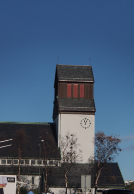
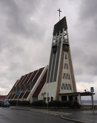
Kirkenes Church
Signs in Norwegian and Russian
Salvation Army store
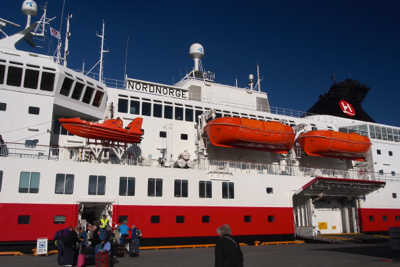
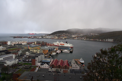
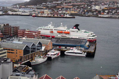
We finally boarded the Nordnorge ship of the Hurtigruten Line. The ship has 211 small cabins to carry 623 passengers, 35 cars and goods, supplies, and mail for the 34 towns we will visit in the next five days. Some stops are for 15 minutes and take place during the night. For instance, it would have been nice to walk around in Tromso, but the boat arrives at 11:50 PM and departs at 1:30 AM. The only thing we hope to see at Tromso will be the Northern Lights (we didn't).
Our cabins were not ready so we went to lunch in the dining room. It was a buffet just like on any larger cruise ship. There were plenty of choices of very tasty food including mussels, shrimp, reindeer meat, chicken, vegetarian dishes, and wonderful salad’s and desserts.
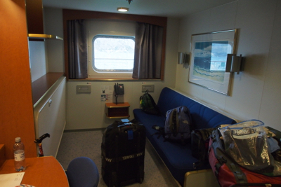
After lunch we found our cabin. Although it is small, there is lots of storage space so we emptied our suitcases and stored them under the wall bed. The other bed converts from a couch. There is a table and a desk with a comfy chair. The bathroom is compact but is very useable. We are on the promenade deck with a good sized window and no obstruction because the life boat is above our window.
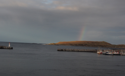
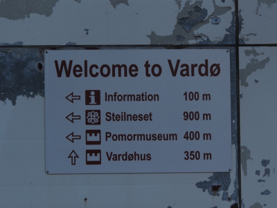
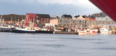
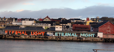
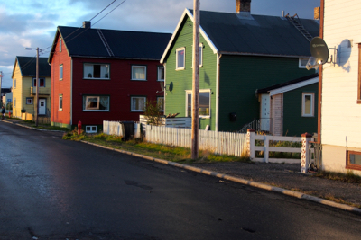
At 4:15 we docked in Vardo for one hour and Eva took us on a tour of the small town. Vardo is the easternmost city in Norway. Fishing is the industry here. A young graffiti artist has painted the sides of a few warehouses. One said “Cod is Great.” Another had about 100 cartoon faces.
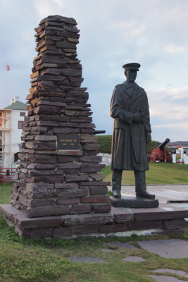
We walked up to the 1700’s fort. It is star shaped. We did not have time to go inside. During WWII the Nazis gave the people two hours to pack their belongings and leave Vardo in trucks before they burned everything in town to the ground.
Embarking Hurtigruten Line's MS Nordnorge
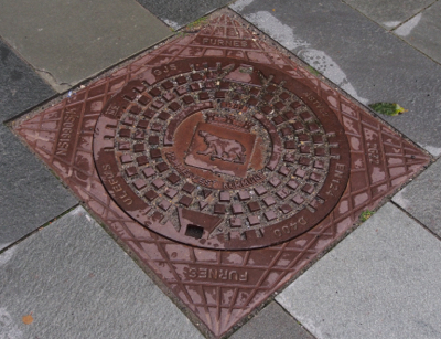
Messy - but you get the idea
Easternmost town in Norway
Vardo, Norway
Cod is Great - Sign for a fishing village
Vardo - another appropriate sign
Vardo street scene
Vardohus Festning (fort) - Memorial to King Haakon VII
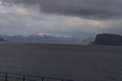
We sailed away right on time at 5:15. The ship headed out into the open water in the Barents Sea and the seas got rough. Several of our people (five of them) left the dining room before the main course was served. I put on a Scopolamine patch and a sea-band and Marge took a Dramamine and used sea-bands. Even with the six-meter waves (nearly 20 feet high) neither of us got sick. Eva postponed the movie she was going to show until the sea got calmer. We rocked to sleep in our beds.
Thurs., 10/1/15 – Norwegian Coast above the Arctic Circle, Hammerfest
The rain over night at sea level put a cap of fresh snow on the hills around the fjords. At breakfast we passed a sister ship going north. Hurtigruten has 11 ships sailing continuously up and down the coast.
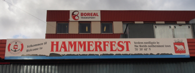
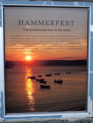
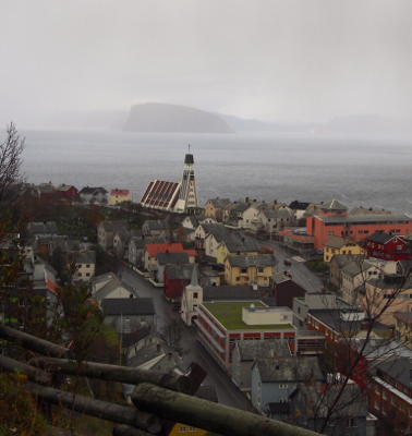
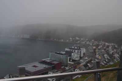
At 10:45 AM we docked in Hammerfest, the northern-most city in the world. It is at the top of Norway at 70° north latitude. The city was occupied by the Nazis and like all of the rest of this coast, they burned the city to the ground after giving the citizens two hours to pack up and leave. Only the chapel survived.
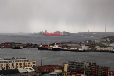
We took a brief city tour which included visiting the Hammerfest Church. We did not get to see the Struve Geodetic Arc, the start of the system of triangulation that was used to measure the curve of the earth using two precise meridians. Hammerfest also has a Polar Bear Club but there were no takers in our group. Natural gas is extracted off the coast with underwater-robotic manipulation and much of it is exported to the US. Norway heats its houses with electricity and does not use oil or gas for heat.
Hammerfest - the northernmost town (definition?) in the world
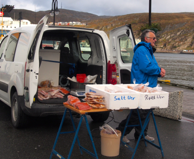
Hammerfest - Fresh fish vendor
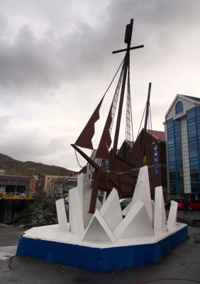
Hammerfest - Sculpture of a sailing ship in an ice pack
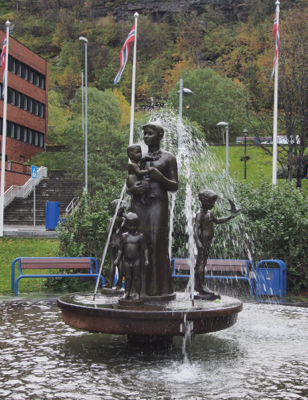
Hammerfest - Mother and Children - gift from former US Ambassador to Norway, Charles Ulrick Bay
Hammerfest
Hammerfest - winter is coming
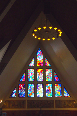
Hammerfest Church
Hammerfest Church
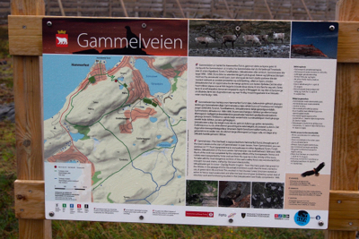
After the church visit, Marge and I walked up a zigzag path, Gammelveien hiking trail, in the rain to an overlook of Hammerfest. At the top were plaques explaining oil extraction in the sea and one stating we are standing at the northernmost city in the world.
After dinner Eva showed us an interesting documentary about Max Manus, the Norwegian resistance fighter, with English subtitles.
Hammerfest - Views from along the Gammelveien hiking trail
Hammerfest - Views from along the Gammelveien hiking trail
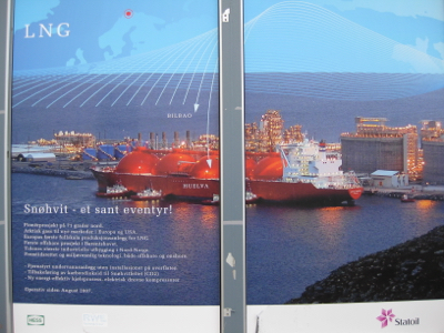
Hammerfest - signs along the Gammelveien hiking trail - about the Liquefied Natural Gas (LNG) plant
Hammerfest - LNG plant
Hammerfest - Views from along the Gammelveien hiking trail
Nordnorge at dock
Hammerfest - Sign at the top of the Gammelveien hiking trail
Hammerfest - at the top of the Gammelveien hiking trail
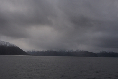
Hammerfest - Views from along the Gammelveien hiking trail - the weather was not nice
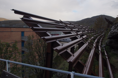
Hammerfest - an avalanche protection fence
Hammerfest - the weather worsens
| Return to Top | Return to Itinerary | Return to Trips page to view other trips | Return to Dreamcatcher Home Page |