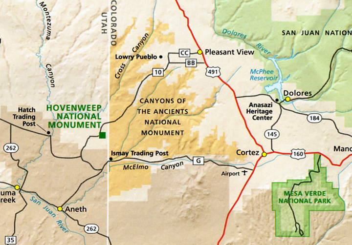
Friday, 10/16 – Cortez, CO to Chinle, AZ
We left the motel at 7:45 and headed west of Cortez. We had to stop the bus at a weigh station for the driver to show his papers. That was a first.
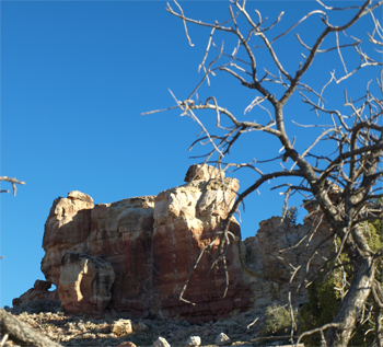
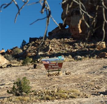
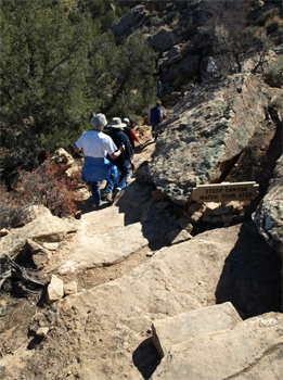
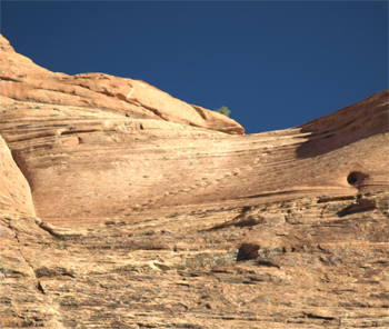
On our way again, we stopped at an area within the Canyon of the Ancients National Monument and stood on a large slab of sandstone and looked at Sand Canyon, which at one time had as many as 70 pueblos. This was just west of Cortez and the scenery was wonderful with cliffs, mesas, and yellow cottonwood trees in the McElmo river valley. It was another spectacularly clear day. This would be a nice place to hike!
|
|
Canyon of the Ancients National Monument - Sand Canyon Area
|
Canyon of the Ancients National Monument - Sand Canyon Area |
|
|
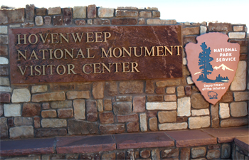
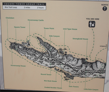
We entered Hovenweep National Monument and spent the morning at the ruins (1240 - 1275 AD) near the visitor’s center.
|
|
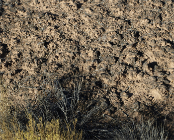
We first took a look at the fragile soil. The area not covered with plant life is covered by cyanobacteria crusts, which help to hold the sandy soil from blowing away and also help to retain moisture. The cyanobacteria are one of the oldest known life forms. Mature forms of the crust also include a combination of moss, lichen, algae, and fungus.
|
Cyanobacteria crusted soil
|
|
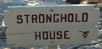
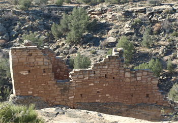
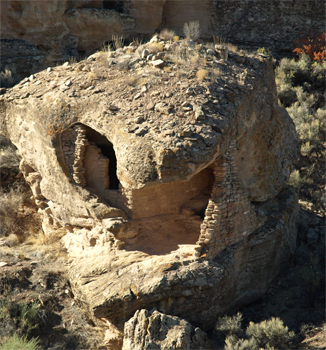
We walked the “ruins trail” stopping first at the Stronghold with its five towers. The masonry is skilled with pecked blocks, mud mortar, and small stones helping to hold the mud. Some of the slots in the towers (round, square, and D-shaped or oval) align with the sun phases and some are like doorways to nowhere.
|
Stronghold House
|
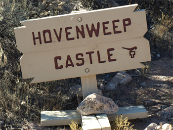
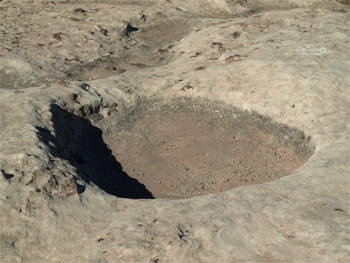
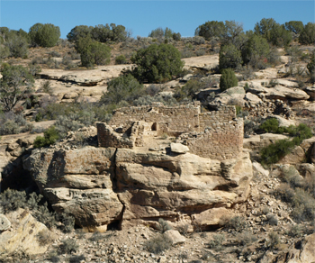
We walked on, taking pictures of the canyon and the ruins, to Hovenweep Castle. To the west was a “T” door, maybe used by a shaman. We looked down into a tower, which also had a “T” door. The walls were aligned with the cardinal directions and it may also have slots aligned with the sun. This tower is at the head of the canyon and may have guarded or defended the spring that was the constant water source here. Rainwater was also easily channeled over the smooth sandstone cap of the mesa into a gated reservoir. There were many large tinaja holes on the rock that would have held rainwater briefly.
|
|
Hovenweep Castle
|
Tinaja or water basin
|
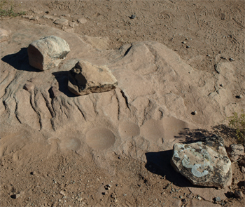
We continued on around the head of the canyon to look back at the other side (south) of the structures. Beside one of the towers was a stone that probably was used to make and mix paint. There were grooves where rock/stone pigments could be scraped off to be mixed with bear grease or deer fat in the hollows below the grooves. Colors could also be mixed in those shallows.
|
Paint Pots
|
Unit House with kiva |
Our group split here and some returned the way we came and several of us continued around the loop and hiked down the rock into the canyon and up the other side. We saw the open side of the structures. The walls were built up from the top of large boulders and more or less took on their shape. We looked across at the large “unit house” and could see a round foundation with a flat floor that may have been a kiva. My favorite structure was “boulder house” that looks like walls inside a lizard or snake-head shaped boulder. No one knows for sure, but it looks like Hovenweep was a religious site where shamen lived and pilgrims came to visit. There is a lot of datura or loco weed growing all over here (the Park Service has tried to eradicate it!) that could have been used by the shamen to put them into a trance. This may also have been an important site that attempted to revitalize the old religion.
|
|
On the trail down into the canyon
|
Boulder House - looks like a lizard or snake head |

Again it was interesting to try to visualize the structures and life among them. I watched the Park Service movie before lunch.
We ate our picnic lunch under the shelters at the visitor’s center - same sandwich, chips, and cookie with our own powdered Snapple flavored water.
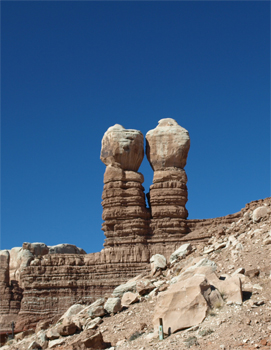
Next we headed south toward Chinle, AZ and Canyon de Chelly (pronounced de shay). We stopped to take a picture (in Bluff, Utah) of the twin war gods or warriors rock formation. We passed more canyons, hiding more pueblos and then entered Arizona. The scenery is stark but the rock formations, mostly red sandstone now, are fascinating. We drove through the “checkerboard” area, which is a mix of Indian owned land, private land, and federal land. We later entered the Navajo reservation. We saw many double and single wide trailers and government built single houses. Many of them had a six-sided Hogan nearby. The Indians believe they are now in the sixth world, hence the six-sided buildings.
The Twin War Gods at Bluff, UT
|
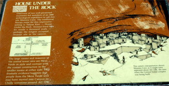
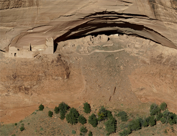
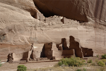
We made a stop at the Mummy Cave overlook into Canyon de Chelly. We were able to look down on a well preserved area with an almost complete pithouse with rooms and a three story square tower. On both sides of it were cliff houses. The area out in front of the cliff was farmland and is still being farmed by Navajos.
|
House Under the Rock - Mummy Cave ruins
|
|
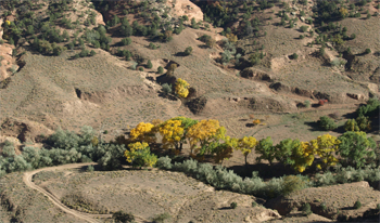 |
Looking down into Canyon del Muerto (the North Canyon) from the Mummy Cave Overlook - Farming is still taking place in the canyon bottom |
|
We checked into our rooms at the Thunderbird Lodge on the reservation at Chinle, AZ.
We took a walk down the road past the rodeo ring and into the little campground that is here in the park. Some sites are dry and some have hookups and all are free! At 6:30 we gathered on our courtyard grassy area, sat on the plastic chairs from our “porches,” and listened to Jay’s slanted view of the Navajos. The Navajo language is of the Athabascan family of languages (as is Apache and Tlingit [in Alaska and western Canada]) so they must have come across the ice bridge and down the mountains, eventually ending up in this area.
We gathered at 7 PM at the cafeteria at this lodge to go through the line as a group. Jay came last and paid the bill. Marge had steam table chicken fried chicken and I had a mystery burrito, beans, and a chili relleno. It was okay. The walls of the dining area have Indian rugs, quivers, medicine wheels, and dream catchers displayed and are for sale. The items were very interesting and the rugs were beautiful.
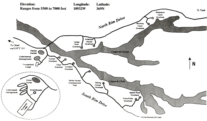
Saturday, 10/17 – Chinle, AZ - Canyon de Chelly National Monument - to Aztec, NM
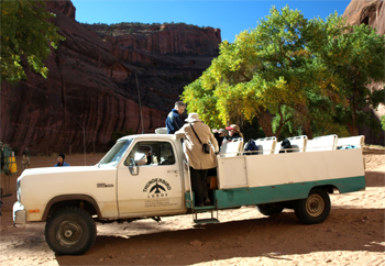
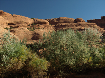
This morning after breakfast in the cafeteria, we got into two 4-wheel-drive trucks for a Navajo guided tour into Canyon de Chelly. In 4-wheel-drive we went right up the sandy river bottom of this huge canyon of red sandstone. The Park Service maintains this national monument on the Navajo reservation and all of the official guides are Navajos. Arnell was our guide. The river bottom is populated in summer by Navajo ranchers and farmers. When the river runs, it can be three or four feet deep and then the bottom is like quicksand. To reduce erosion, Russian olive trees and tamarisk (salt cedar) were planted with the existing cottonwoods. This was a mistake as now they are choking the riverbed and are having to be chopped down and/or burned out.
Canyon de Chelly National Monument
|
|
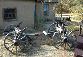
We won't call this a chariot
|
Tamarisk and Russian olive trees
|
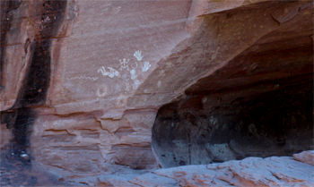
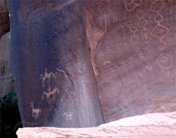
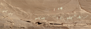
The first stop by our open-bed truck was to look at pictoglyphs of a white hand (dipped in paint and placed on the rock) symbolizing birth, a negative hand (hand placed on rock and white paint sprayed by mouth over it) meaning death, a snake sometimes representing flowing water, and a kokopeli. These were made by Navajos, but the canyon probably housed the Anasazi until around 1200 AD, and later, Navajos and Apaches moved in. A little farther on we looked at petroglyphs pecked into the rock. There was a scene of horseback hunters chasing a deer. The horses arrived with the Spanish. The hunters would chase a deer until it fell down and then stuff something in its nose to suffocate it. Therefore, there was no bullet or arrow hole in the hide. We saw glyphs of a chain, a snake, and Hopi pottery - all signifying clans who lived in the canyon at some time. There is also a snake dancer and a Spanish conquistador. I find these drawings fascinating.
|
|
Pictoglyphs |
Petroglyphs
|
Steps (footholds) to the top of the cliff
|
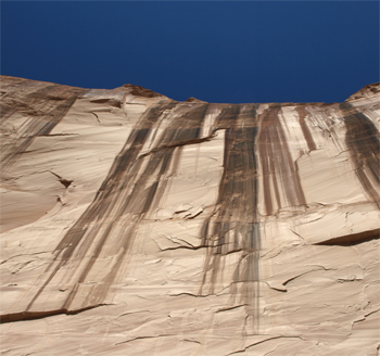
Water runoff at Fortress Rock
|
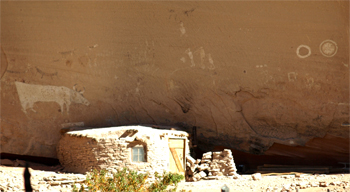
Standing Cow house and farm We turned around at Standing Cow house and farm. An old woman here asked the US government for another cow and the government painted one on her cliff instead of giving her an animal. We could see the posts of her loom beside her 1930’s stone house. There is rubble from Anasazi ruins here and a hogan for the farm still in use today.
|
|
Pictoglyphs of Spanish soldiers at Massacre cave At Massacre Cave pictoglyphs show the story of a Navajo woman attacked by a Spaniard on this cliff. She jumped off the ledge with him killing them both. The other Spaniards then shot and killed the rest of her pueblo. Two days of fighting are indicated by two pictoglyph suns. There are also dancers and a yellow circle calendar from happier days painted on the wall.
|
|
White House ruins Up the South Canyon Canyon de Chelly) we stopped for 10 minutes at the White House - so called because the upper level houses were painted white. The lower structures were built high enough to give access, by ladders, to the upper units.
|
|
We bounced along in glorious sunshine over the sand to our lodge and lunch in the cafeteria. Marge tried the Navajo taco. It was a plate size fry-bread with chili beans, hamburger, tomato, and cheese and was an interesting and tasty combination. I had a veggie burger.
Back on our tour bus we watched a PBS video on our way to Aztec, NM. Alan Alda hosted a look into early inhabitants of the Americas. A femur belonging to the “Arlington Springs Woman” was found on Santa Rosa Island off the California coast and was carbon dated to 13,500 YBP. How did she arrive on that island unless people of that era had some kind of boat? Clovis points (those narrow, 2 faced stone spear heads with a bifurl at the attachment end) were found all across the present US indicating occupation at least 13,000 years ago. The theory is that maybe the Clovis era people used boats and followed the ice sheets across from Europe and/or Asia instead of waiting for the Alaskan land bridge.
We stopped to take a good photo of Shiprock and later drove through the Navajo town center of Shiprock. We cannot get close to the rock formation because it is a sacred site. The formation is the result of a volcanic “throat.” Hot molten rock stayed inside the volcanic cone and did not erode as the rest of the cone did.
We checked into our room at the Step Back Inn in Aztec, NM. It is a funky motel. The furniture and drapes, etc., are Victorian. There is no maid service; we had to make our own beds in the morning.
The bus drove us to dinner at Oliver’s. The portions were huge. Our taco salads were too much to finish. More wasted food.
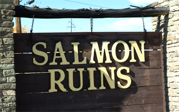
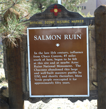
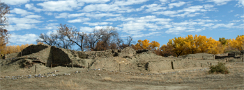
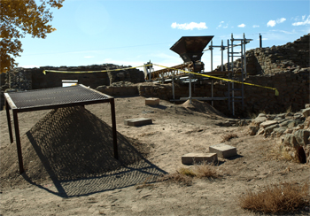
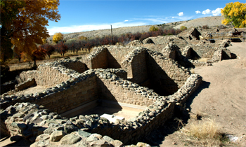
This morning we toured the Salmon ruins. In 1893, a man named Salmon created a homestead here. The remains of his root cellar, bunkhouse, corral, orchard, and house are still standing. They are crudely built structures. He did, however, preserve the Anasazi and Chacoan ruins on his property and kept out the artifact thieves. The Indian ruins were built around 1070 and were occupied by Chacoans and later were reoccupied (after 1160) by other Puebloans. Two to three hundred people probably lived here and there were many rooms and kivas. Some of the structures were three stories high.
|
|
Salmon Ruins
|
|
Salmon Ruins |
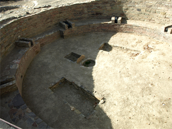
Tower Kiva
|
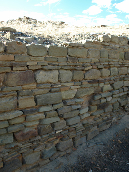
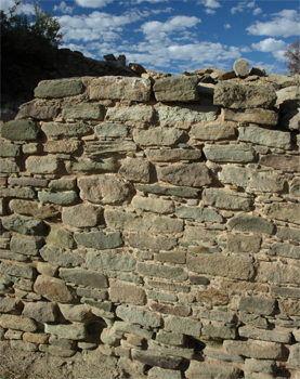
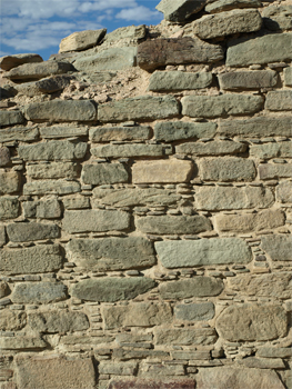
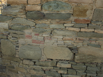
We began to see different types of Chacoan masonry and then the “McElmo” style put up by later inhabitants to create more kivas than the original two Chacoan ones. The people who reoccupied similar sites, built the round kiva walls inside an existing square room. The masonry is very different. Type III masonry has bread loaf sized blocks in one layer and stripes of smaller tabular stone forming the in-between layers and was very neatly done. Type II masonry uses smaller blocks with the chips pounded into the mortar. These were often in neat rows as well.
|
|
Masonry construction walls
|
Masonry construction walls |
Masonry construction walls
|
The pattern of red sandstone might have indicated the builder or the clan who lived there. |
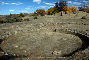
The Great Kiva here is the first large kiva we have seen. It has four bases on the floor that would each support a pillar of three or four tree trunks lashed together. This support was necessary to hold up the weight of the large ceiling/roof. The kiva has an antichamber that might have been where the shamen prepared for a ceremony. The rooms facing the plaza outside this kiva all had T doors indicating that was where the priests/shamen lived. The Great Kiva is on a true North-South axis.
|
Roof construction |
Old farm building
|
Old farm equipment |
The Chacoans may have moved out of this site because the astronomical and spirit lines were not correct at Salmon.
There is still some excavation going on here but much of the site has been back filled with dirt to preserve it. The dig area is covered with black plastic, a penny is thrown in to indicate the year that the area was backfilled. This is the best way to preserve the ruins for later generations to study when better techniques might be invented.
After lunch at Oliver’s (we are so full of food and not getting enough exercise!), Jay gave a short lecture to recap the history of the sites we have been seeing. There is a natural progression from the 8000 BC to 1 AD Archaic period through the basketmaker period (1 - 450 AD) and through the Puebloan period – 1100-1300 AD - when these Indians disappeared from here due to drought, violence, climate change, massacres, or whatever.
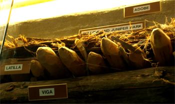
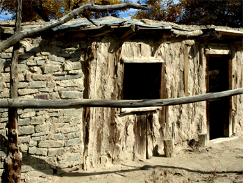
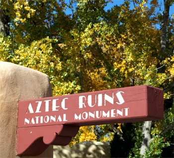
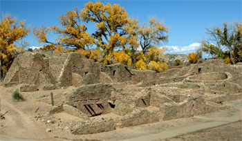
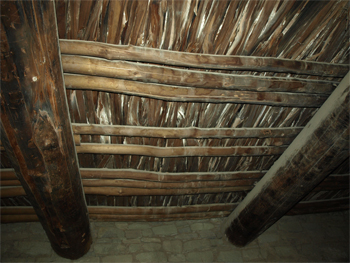
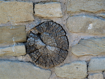
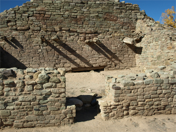
We then went around the corner to the Aztec Ruins. These were built around 1120 to 1270 AD and were occupied by Chacoans and then reoccupied. This is a large, relatively intact site. Originally there were 500 rooms and some still have their roofs. There are many original viga, logs with smoothly found ends. The latillas and door and window lintels are original. The small holes in the wood were the result of core samples taken to verify this.
|
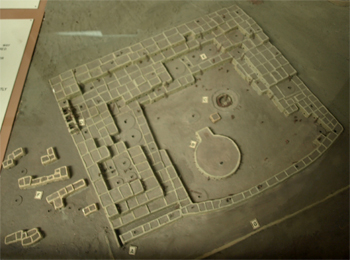
Site model |
Aztec Ruins Map
|
|
There is some research still going on and a lot of backfilling to preserve various structures.
|
West ruin |
West ruin |
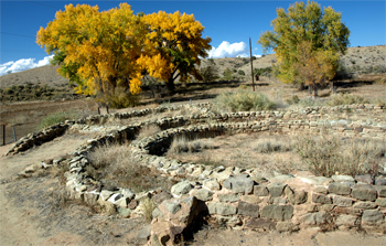
There is a mysterious Hubbard tri-wall structure outlying the village. It was 12 feet deep in a man-made hill.
|
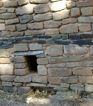
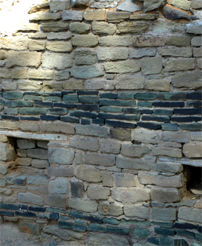
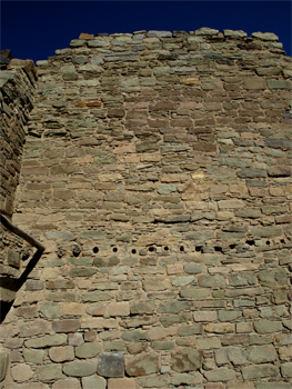
Around the outside wall is a double line of green stones (referred to as a greywacke stripe) that is thought to be a snake like the Aztec’s Quetzalcoatl.
|
|
Green sandstone band
|
Green sandstone band |
Roof vigas and latillas
|
Original viga |
Holes and original vigas
|
T-door, original wood beams, and lintel (backfilled) |
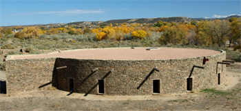
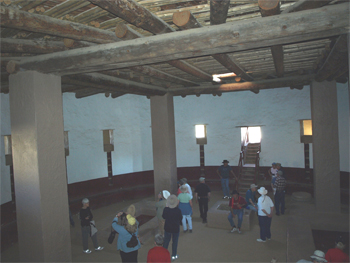
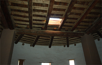
We entered the rebuilt/replica of a Great Kiva. It was built to give tourists a feeling of being in a Kiva. It has four inside columns to support a pilaster and mud roof. There are 14 anti-rooms around the outside and the two mystery boxes on the central floor.
|
|
Great Kiva |
Interior of the Great Kiva with large columns supporting the roof
|
Great Kiva ceiling |
Great Kiva - Ladder and door leading to one of 15 small rooms of unknown usage
|


| Return to Top | Return to Itinerary | Return to Dreamcatcher Home Page |