Wed., 7/5/23 - Kinnvika and Crozierpynten
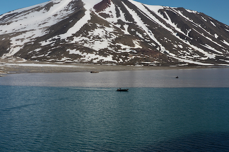
This morning we anchored off Kinnvika which is located in the Murchison Bay of the Murchisonfjorden. Our group was in line to board the Zodiacs when the landing was aborted because of polar bears in the area. All dressed up for nothing. |
|
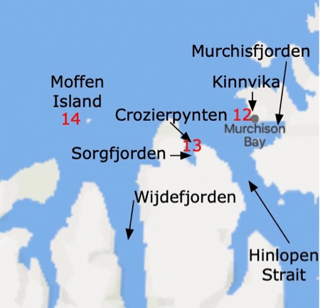
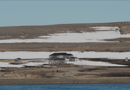
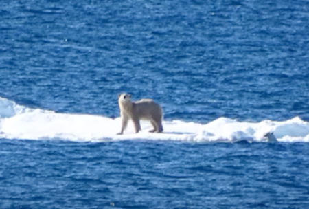
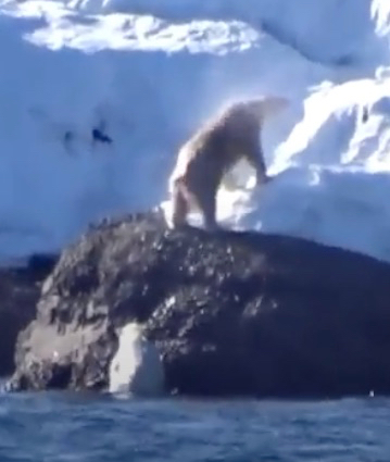
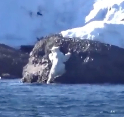
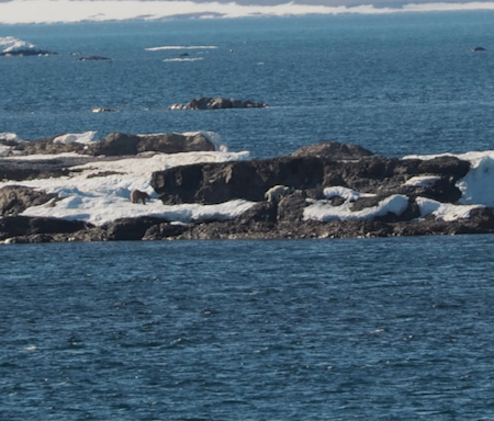
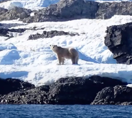
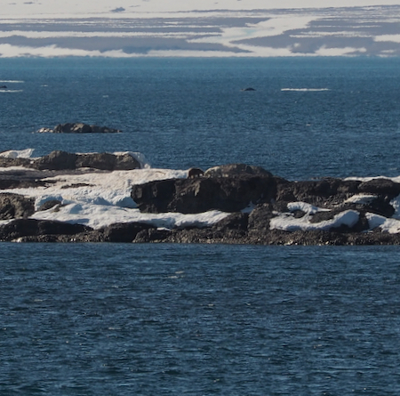
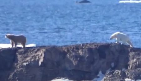
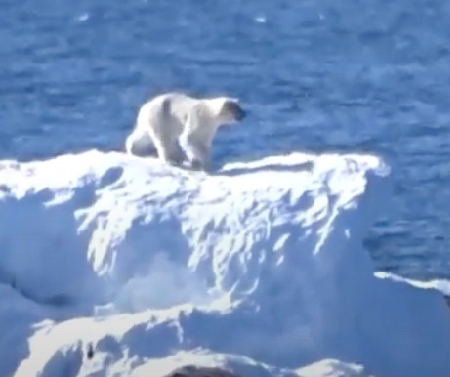
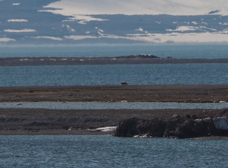
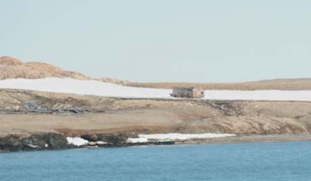
Kinnvika is an abandoned Swedish research area and there are still a few weathered buildings at the site. On our way into this fjord Gale saw a white polar bear so we were not surprised at the decision not to land. Instead, nearly everyone on the ship stood on deck looking for polar bears, plural. A mother (white) and cub (brown) were sighted on a nearby peninsula (or island) and then they disappeared (much too far away for photos). Our captain chased them around the peninsula and they were next spotted on an ice floe (we didn’t see them there) and in the water swimming toward land. Then everyone watched them climb out of the water, move up a rock, and walk across another peninsula before disappearing from sight. There were also four reindeer on the spit of land. There was also a Minke whale not far from our ship. We got very cold standing outside looking for the bears and a hot lunch was very welcome. (The photos below that are preceded by an * were taken by one of the Expedition Team who has a much larger lens than I had.)
Approaching Kinnvika
Abandoned research station at Kinnvika
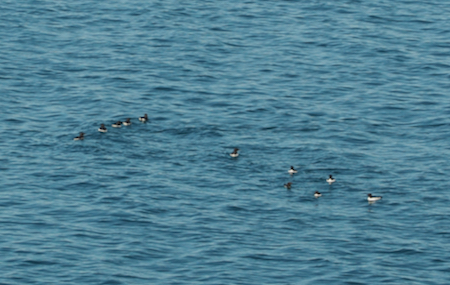
A group of thick-billed Murre floating about in the water
*Polar bear on an ice floe
*Climbing out of the water and shaking
*Second bear out
Both bears out
*Looking back at us
Bears head-to-head
*Moving on
*Nice photo
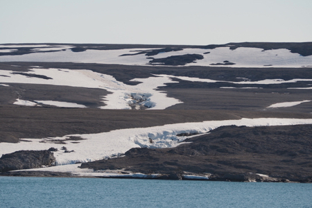
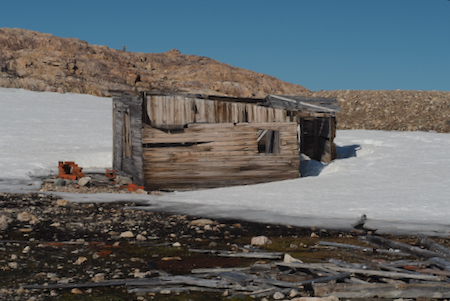
After lunch we stopped at Crozierpynten, a small peninsula on the eastern side of Sorgfjorden. The location has been visited over the years by a veritable who's-who of Arctic explorers.
The ruins are those of installations that the Swedish built at the very end of the 1800s. Swedish and Russian experts collaborated to carry out a massive research project that stemmed from the question of the exact shape of the Earth – the Swedish–Russian Arc-of-Meridian Expedition. The purpose was to try to determine whether the Earth was flatter at the poles, as Isaac Newton had suggested.
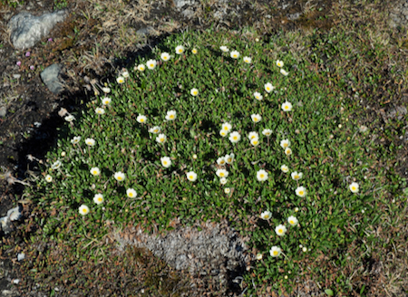
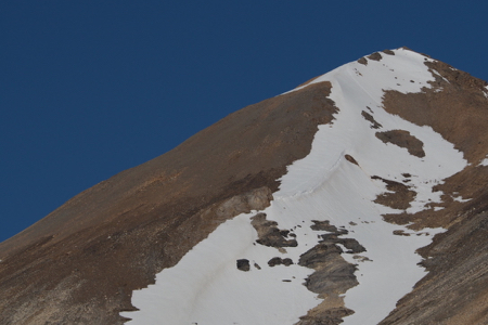
One building, minus its roof, remains, as well as the lumber of another demolished building. We were able to make a landing on a small beach and walk up a pebbled moraine for a 360° view with about four reindeer very far away. The view was wonderful in the clear, sunny air.
Ruins
Ruins
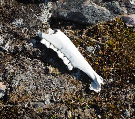
Someone's jaw bone
Whitlow grasses
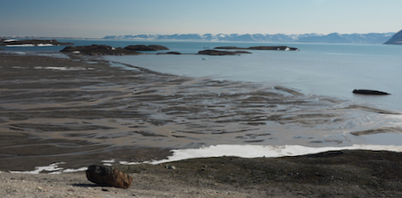
The Sorgfjorden
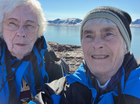
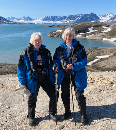
A "we were there" selfie
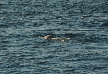
Minke whale
Minke whale
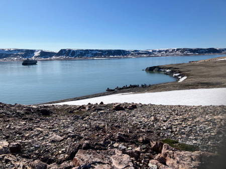
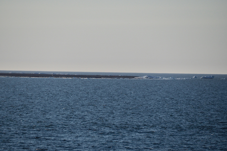
After about 10:30 pm, we sailed past Moffen Island, a small, very low island north of the entrance to Wijdefjorden. It lies just north of 80°. We saw four or five Minke whales cavorting in the water, but no walruses.
Moffen Island
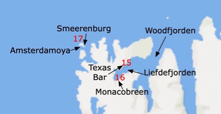
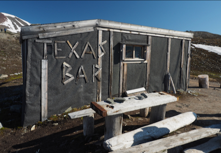
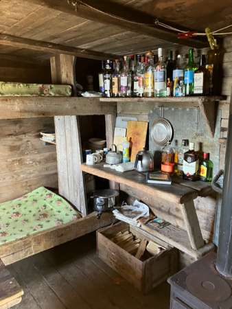
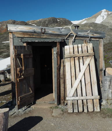
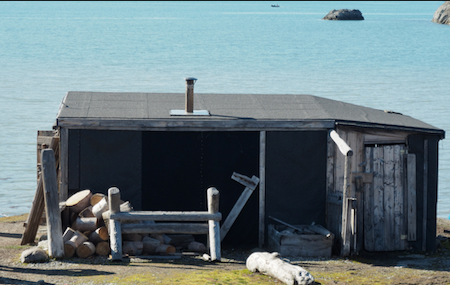
Thurs., 7/6/23 - Texas Bar and Monacobreen Glacier
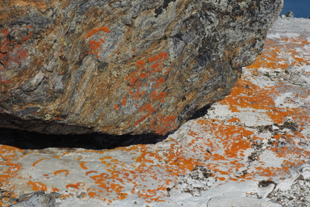
This morning’s Zodiac excursion was a stop at the Texas Bar in Liefdefjorden, a fjord branching south and west off the Woodfjorden, the fourth largest fjord in Svalbard. Someone built a shack on the beach and stocked it with kindling and fire wood and shelves of hard liquor. The room has a bunkbed, table, and benches, and a Franklin-style stove. An entry room had space for provisions. It is, of course, a tourist attraction now.Better yet was the hike up a moraine to another 360° lookout. Below the highpoint, there was a red throated loon in a tarn and a huge glacial outwash plain that created a muddy run off and a “meeting of the waters” out in the bay. There were nesting terns on the outwash plain. It was nice to get out and walk in the warm sunshine and among the tundra flowers. The lichen-covered rocks were very pretty.
Texas Bar
Texas Bar - interior
Texas Bar - entry
Texas Bar - rear view
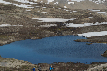
Small lake along the path of our hike
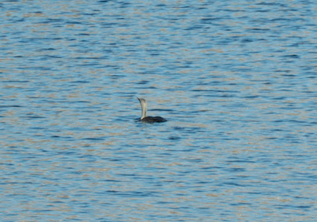
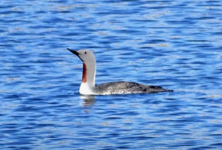
Red Throated loon, my photo (above) and that of one of the Expedition Team with a much better lens.
Glacier's outwash plain
Meeting of sediment-filled water from the glacier outwash plain and the water in the Liefdefjorden
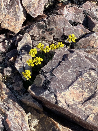
Mountain Avens
Rocks and lichen
At Liefdefjorden
Cairn atop the hill - serves as a marker
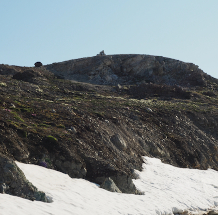
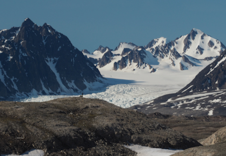
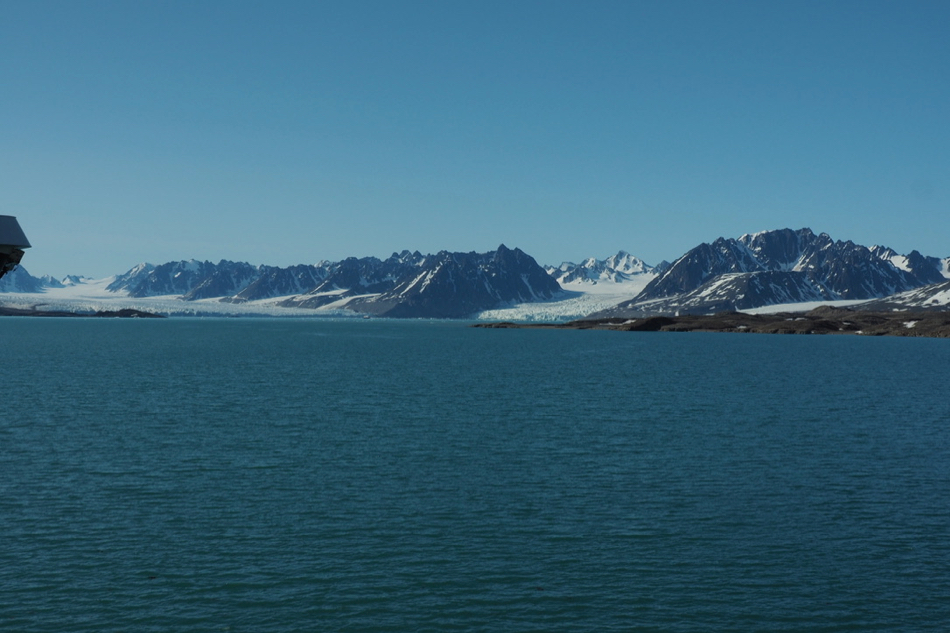
At the top of the hill we hiked to - that's the Monacobreen glacier in the distance
Someone's footprints
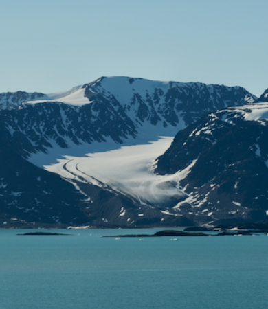
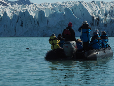
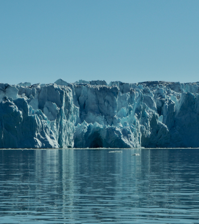
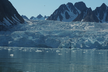
The afternoon Zodiac ride was to the south end of the Liefdefjorden to see the Monacobreen and Seligerbreen glaciers. In 1999 these glaciers had a common terminus that was more than 4 miles wide. By 2013 the glaciers had separated around the mountain that now appears between them - the Stortingspresidenten - and the tidewater terminus of Monacobreen alone was 2.7 miles long. Monacobreen also retreated 1.7 miles from 1999-2016.
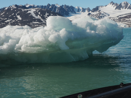
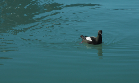
There were a few bergy bits and growlers in front of two large glaciers. There was no calving. We saw the head of one seal who was probably feeding in the water. There were a few birds - fulmars, terns, gulls, a line of eider ducks, and a red web-footed something (probably a Black Guillemot) paddled over to check us out and then flew off.
Medial moraines on the left of this glacier
Seligerbreen glacier
Monacobreen (left) and Seligerbreen glaciers
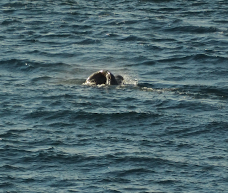
Head of a seal - the only one we "saw" on the trip
Monacobreen glacier
Monacobreen glacier
Bergy Bit
Black Guillemot
Seligerbreen glacier


| Return to Top | Return to Itinerary | Return to Trips page to view other trips | Return to Dreamcatcher Home Page |