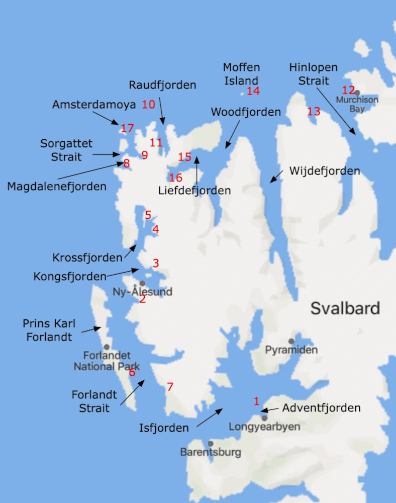
Below is a list of the places we visited followed by their location.
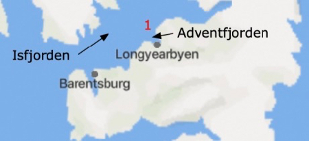
1 - Longyearbyen - Isfjorden - Adventfjorden
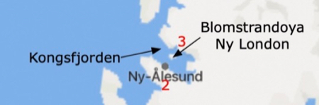
2 - Ny Alesund - Kongsfjorden
3 - Ny London - Kongsfjorden - Blomstrandoya
4 - Tinayrebreen - Krossfjorden - Tinayrebukta
5 - Hotel Lloyd - Krossfjorden - Mollerfjorden
6 - Poolepynten - Prins Karl Forland
7 - Eidembukta - Forlandt Strait
8 - Gravneset - Magdalenfjorden - Gullybukta
9 - Smeerenburgbreen - Smeerenburgfjorden - Bjornfjorden
10 - Polar Ice - above 80°
11 - Hamiltonbukta -Raudfjorden
12 - Kinnvika - Hinlopen Strait - Murchison Bay
13 - Crozierpynten - Sorgfjorden
14 - Moffen Island
15 - Texas Bar - Woodfjorden - Liefdefjorden
16 - Manacobreen - Woodfjorden - Liefdefjorden
17 - Smeerenburg - AmsterdamoyaNote: In Norwegian:
Fjorden = Fjord
Bukta = Bay or cove
Breen = Glacier
Oya = Island
These are the places we actually went on our Arctic adventure
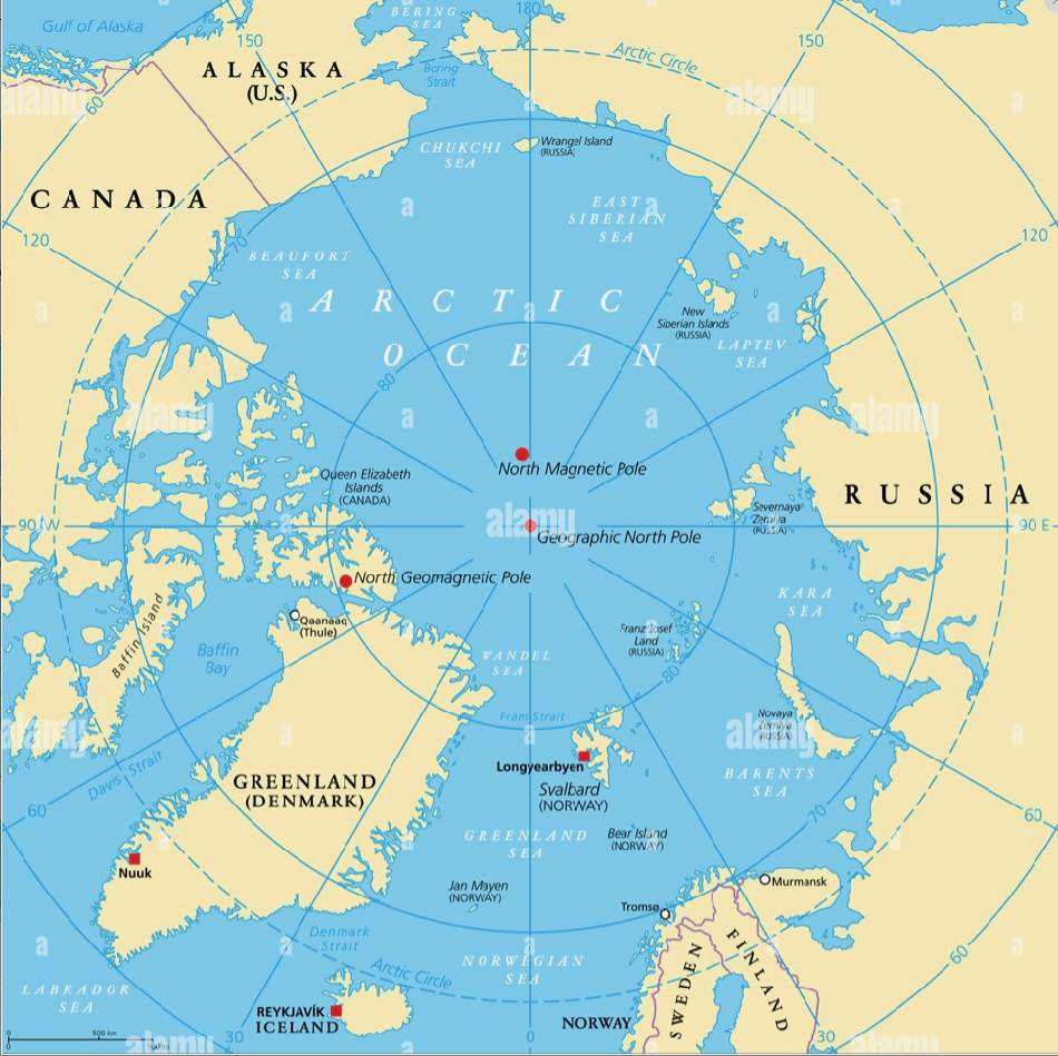
This circumpolar map shows just how far north we were. The innermost circle of latitude is 80 degrees.
Our ship was able to go just above this to 80°33'19' north.
Svalbard, or Spitsbergen, is an archipelago, or group of islands, in the Arctic Ocean. The Svalbard Treaty of 1920 recognized Norwegian Sovereignty over the region and the Svalbard Act of 1925 made the area a full part of the Kingdom of Norway.
Svalbard is the farthest north a person can fly on a scheduled (commercial) flight.
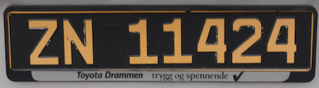
Svalbard license plate
Thurs., 6/29/23 - Oslo to Longyearbyen; Embark the MS World Traveller
This was another of those long travel days that are no longer fun or exciting. Up at 4:30 AM; picked up our breakfast bag - sandwich, pear, apple juice, and yogurt at 5 AM; 40 minute ride to the airport; check in at 6:30 for our 8:00 departure on a charter flight to Longyearbyen. The flight finally departed around 10:30 for the 4-hour+ flight to Longyearbyen.After the flight finally arrived around 2:30, everyone was bussed into town where we spent a couple hours wandering around before finally taking a 30-minute hike to the tender dock for the ride out to the ship.
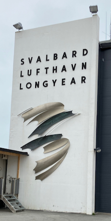
Welcome to the Longyearbyen airport
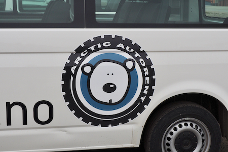
Logo for the local transport bus
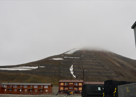
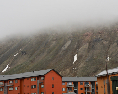
Avalanche control above town
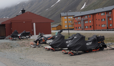
Waiting for winter
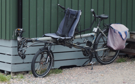
Very interesting adaptation: part regular, upright (rear) and part recumbent (front)
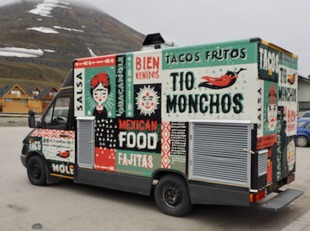
Mexican food is everywhere in the world
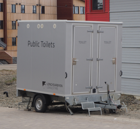
Better than nothing!
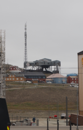
Coal processing facility
Two old mines up on the hillside
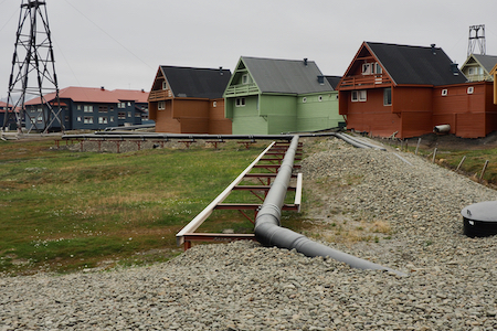
Pipes carrying heat to buildings and homes in town
No idea where they play! Maybe indoors?
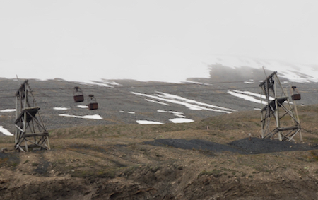
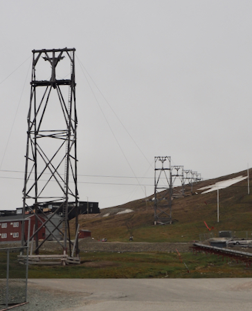
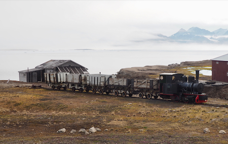
In the early decades of the 20th Century, a network of aerial bucket conveyors hauled coal from mines at several points in the valley to a central terminal where the coal was consolidated for delivery to ships in the Port of Longyearbyen at the bottom of the hill.
Conveyor supports
The unknown miner drills into mid-town coal reserves.
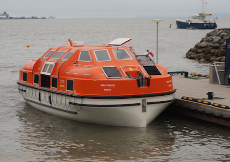
Tender to transport us to the MS World Traveller
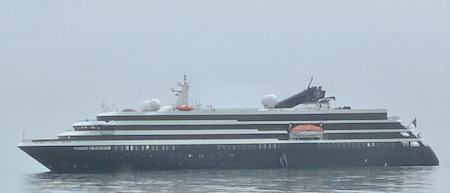
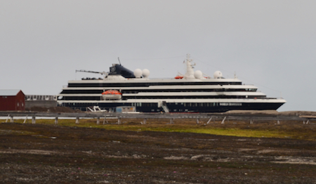
MS World Traveller
By 5:30 we were finally on board where we found our nice, upgraded stateroom (courtesy of OAT). A “lunch” in the lounge - canapés, sandwiches, soup, and champagne was followed by the mandatory lifeboat drill and then a session in the theater where the crew and the expedition team presented a video and lecture on AECO - the Rules for the Arctic written by the Association of Arctic Expedition Cruise Operators. The rules try to coordinate the sustainable use of the water, land, flora, and fauna of the area north of the 60th latitude.
Dinner was at 8 and was generally good. Bed at 9:30 was better. It was a very long day.
Fri., 6/30/23 - Ny Alesund and Ny London
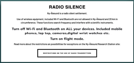
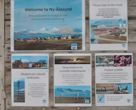
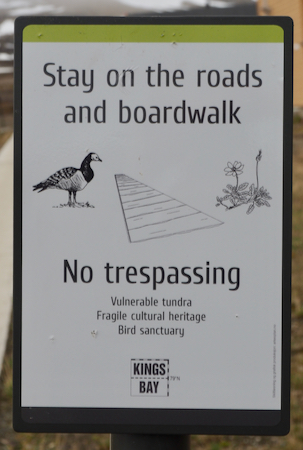
Ny Alesund is the most northerly permanent settlement in the world. It is located on the shore of the bay of Kongsfjorden (see June 30 on the actual trip map) and is a "company town" operated by Kings Bay AS. Since January, 2017, the company has been owned by the Norwegian Ministry of Climate and Environment. The town is designated as a "research station" where scientists from all over the world conduct a wide variety of scientific inquiries ranging from climate, to flora and fauna, astronomy, and many others. Some of the research requires "radio silence" so the town rules require you to turn off all radio transmitters and the Wi-Fi and Bluetooth on all mobile phones and computers.
Since the MS World Traveller was docked at Ny Alesund, we were easily able to get off and wander around the town.
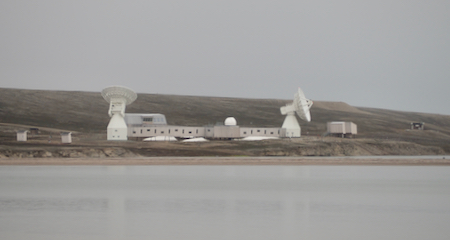
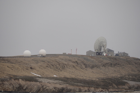
The geodetic observatory’s Brandal site with 13-m twin telescopes
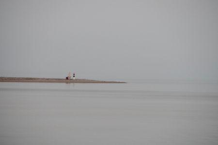
Lighthouse
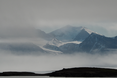
Scenery
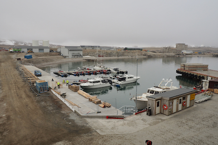
Port at Ny Alesund
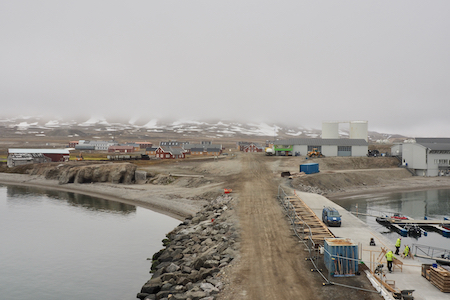
Ny Alesund
Information
Satellite data receiving station
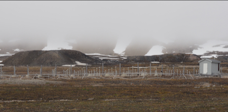
Research project
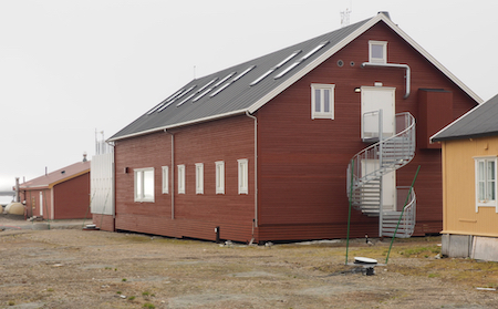
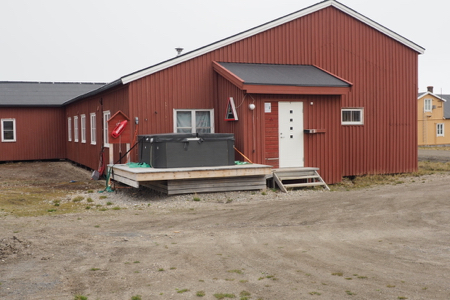
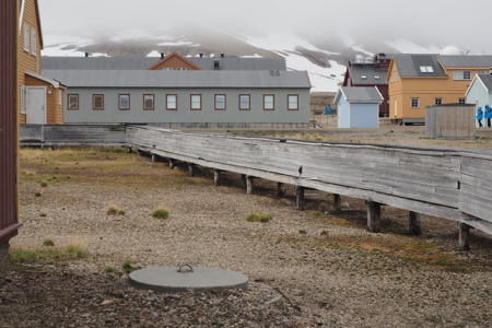
Local buildings
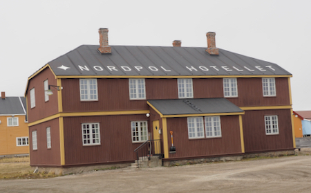
Hotel
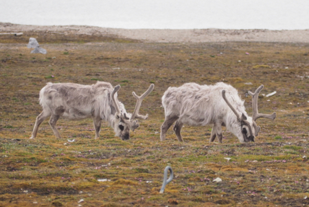
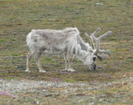
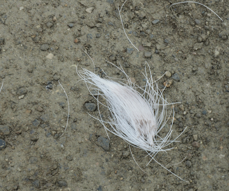
Reindeer - shedding
Reindeer
Reindeer hair - found all over the place at this time of year
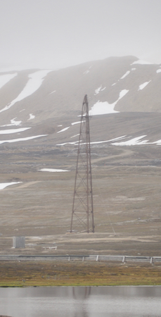
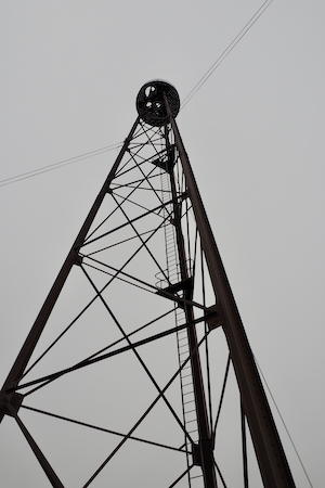
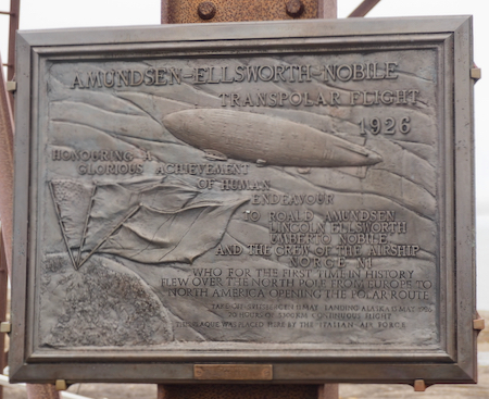
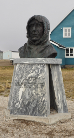
One of the "sights" in Ny Alesund is the mast from which Roald Amundsen and Umberto Nobile flew the "Norge" airship from Svalbard to the North Pole in 1926.
Mast from below
Hot tub
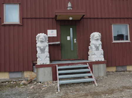
Chinese research station
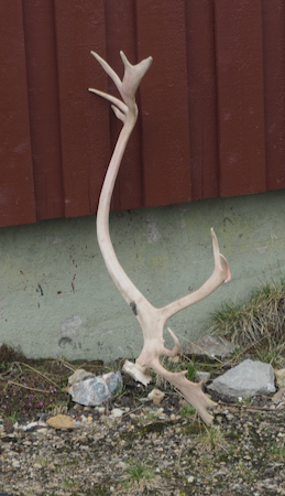
Reindeer antlers
Statue of Roald Amundsen
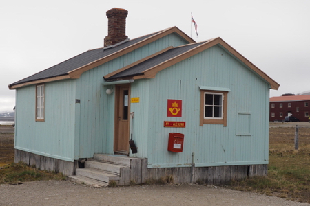
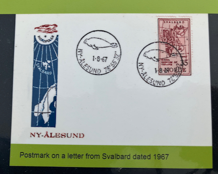
Northern-most post office in the world
Style over the heating system
Protected heat ducts
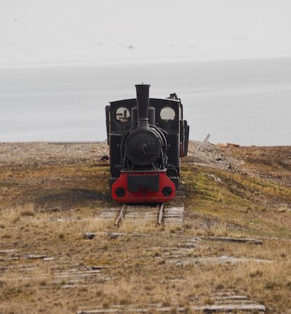
Engine from coal mining train
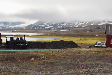
Engine and cars from coal mining operations
Tundra view
MS World Traveller at dock
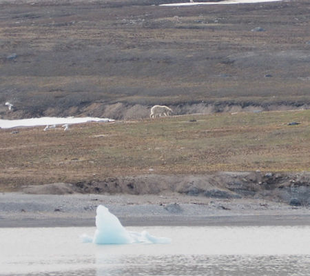
As the MS World Traveller was making its way from Ny Alesund to the site of our first Zodiac landing at Ny London, we sighted our first polar bear running across the tundra. Polar bears are remarkably fast runners and very dangerous predators. For this reason, you seldom get very close to them. All of our sightings were at a considerable distance, requiring binoculars and telephoto lenses that result in very small images!
First polar bear
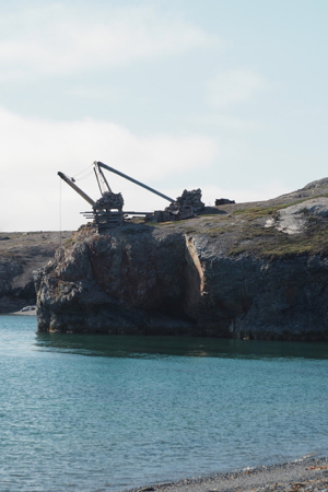
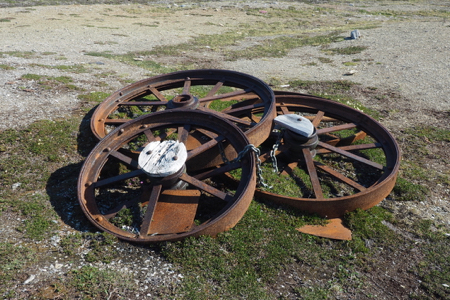
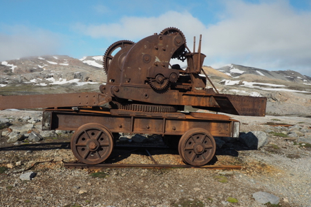
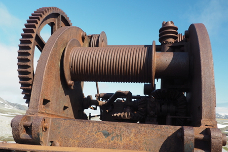
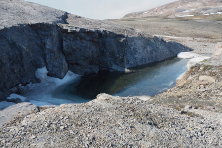
The first Zodiac landing of the trip was at Ny London, an abandoned mining settlement located on Blomstrandoya island on the northern side of Kongsfjorden.
Ernest Mansfield, a prospector, established the settlement because he thought he had discovered deposits of pure marble on the island in 1906. A mining operation was established but when the marble, that was found in a cold climate, was sent off to England in 1912, it disintegrated in the warmer climate, rendering it useless as a building material. The mining operation was abandoned in 1920, after years of little or no activity.
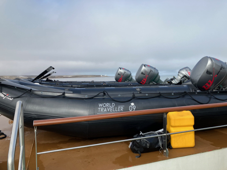
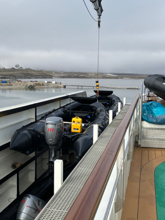
Our Zodiacs
Preparing to launch a Zodiac
Preparing for a Zodiac landing: What a process! First, in your cabin, you put on all the warm clothes you think you will need - always including your rain/water pants - and then wait until your group is called to proceed to the "mud room." One group (20-25 people) at a time goes down to the mud room on deck three where you put on your Wellington boots (rubber, almost knee-high, and supplied by the ship) with your rain pants over the outside of the boots. Next comes the heavy parka and then the Zodiac life vest - a complicated affair with a chest strap and straps that go between the legs - it is not like an orange life vest, but much less bulky. By now you feel like a stuffed sausage and can hardly move. Each person is helped one-at-a-time down the landing stairs and into the boat - 10 people per boatload - where you slide along the gunnels to your place - NEVER stand up (unless you are an Expedition leader).
On returning from an outing, the process is reversed except that you get a hot drink liberally amended with whisky or rum that you can take to your room to help you get out of all those clothes.
All of the Zodiac landings are "wet landings" meaning that you swing your feet over the side of the boat, stand up in mid-calf deep water and wade ashore - not a problem.
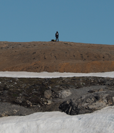
One of our "minders"
For all landings, trained Expedition staff are stationed at least 300 yards beyond the area in which we are permitted to walk. They are armed with rifles and are watching for polar bears. Their instructions are to deter any bear that approaches and they would only shoot to kill the bear if it continued to approach the group or if it attacked. Meanwhile, if a bear is sighted, the Expedition team immediately begins an evacuation of everyone in the area - back to the ship.
Abandoned mining equipment
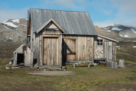
Camp Mansfield - abandoned cabin
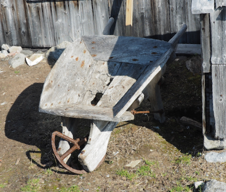
Old wheelbarrow
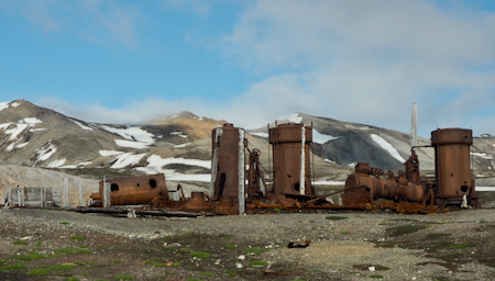
Abandoned mining equipment
Abandoned mining equipment
Abandoned mining equipment
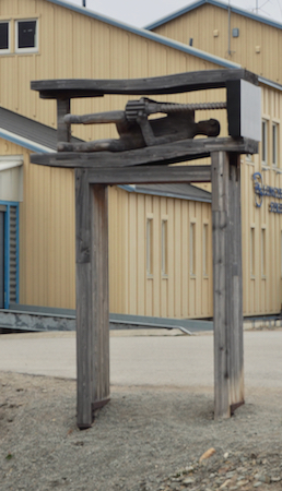
Windlass
Minder with a view
Still looks like winter up here
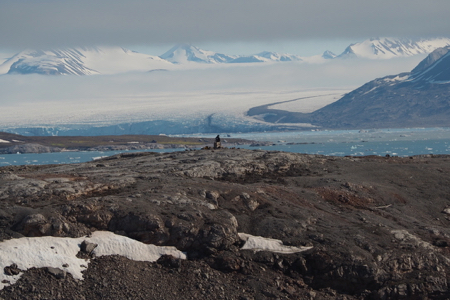
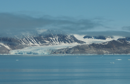
Tidal glacier